Sunday, July 26, 2015

The Long Way Home - Day 27 - Two Dumbs make a Smart

Sunday, July 26, 2015

Our day started in Ouray, Colorado and we were faced with a decision: Would we head over the optional Black Bear Pass or stick to the easier Imogene Pass.  Truthfully, I was really sore and stiff from yesterday's crash but I was still on the fence.  Then we looked at the weather and it was calling for thunderstorms all across the area which caused me to chicken out.  If I had a picture of a chicken I'd post it right here:

Imogene Pass would lead us into Telluride and from there we'd head west to Monticello, Utah.
 

Leaving Ouray we snapped this photo.  It's clear why this area is known as the American Alps.


The trail up Imogene Pass was spectacular and it made me forget all about Black Bear Pass. 


Over 13,000 feet!

I was busy stopping at every corner to take pictures but Hank found a good spot to wait.  

From Imogene Pass, we headed west to Telluride.  Heading down into Telluride we could see Black Bear Pass.  The switch back road leads up to the pass which is out of sight to the left.
There were no thunderstorms and it looked so close.  Now it appeared that our first decision to skip Black Bear Pass was a dumb decision so we thought lets make another dumb decision and go back up and then down Black Bear Pass. - Brilliant!  We hustled down the remainder of Imogene Pass Road, through Telluride and up Black Bear Pass.  About 80% up the mountain, there was a sign saying that only downward traffic is allowed.  Shoot.... we didn't come all the way up here to not go up the pass.  We continued thinking that we could easily get out of anyone's way.  It all worked out and we made it up and back down.    


We met John and Chris working their BMW 1200s down the pass.  Our bikes went up and down  pretty easy but these big bikes are a real workout on this stuff.  We helped them down a tiny portion of the tough stuff and they insisted on buying us lunch in Telluride.  -That's our second sponsored meal!  Thanks guys and good luck on your adventure.


Telluride

After lunch with John and Chris in Telluride, we started on the remainder of the day.  We had only covered 35 miles of our planned route and it was 3pm.  Hank made me promiss we wouldn't stop for pictures so there are no pictures of the next 150 miles!
....except for this one I took while riding!  I was shocked to see how fast the terrain changed from mountains to farmland.  

We pulled into Monticello, Utah around 8pm.  It was another long day but the two dumb decisions resulted in us getting up and down Black Bear Pass which we've been thinking about for a few weeks.

Tomorrow is a long day and we have a deadline of 2pm to make the ferry at Hall's Crossing or we don't get a bed for the night!  The green line on the map shows the route.  It's just over 200 miles and we're thinking that we have never made that distance by 6pm -four hours too late.  We're going to have to come up with a new approach!

Thank you for following us.

Follow us with Spot Tracker by clicking on this link:


The Long Way Home - Day 26 - Good News, Bad News

We were eager to get started this morning after taking 4 days off to take the round trip to San Diego and back.  I got up early to change out my clutch that had burned out when we were in the back raods of Maine.  Our quick fix of the clutch amazingly lasted another 5000 miles but it was starting to show signs of failing again so we changed that out before the tough Colorado and Utah sections coming up.
The ride for day 26 takes us from Salida, Colorado to Ouray, Colorado.  This really gets us up into the great divide.  We will cross Engineer Pass at 12,800 feet right before decending into Ouray for the night.
Our day started out with an option right away.  We choose the tougher single track option shown in red on the map.  Good news: This was fantastic, tough single track and very beautiful.


We were impressed by this beaver dam.  It was more that 10 feet tall on the downstream side and it was 100 feet wide.  Amazing engineering!   

Not all of the trail was smooth single track.  Lots of it was rocky hill climbs and downhills like this one.


We met this couple on their bikes.  When they heard we were headed to Ouray they replied, "How the @*& are you getting to Ouray from here?".  We weren't exactly sure but we knew we had to head west.  They pointed to a mountain on the horizon and said Ouray was past that.  Wow, we better get going. 
They have two young kids and were wondering if they could get them on the Trans America Trial in a few years.  They offered to pull out their recreational cannabis to give us the full "Colorado image" for the photo (they were only kidding... i think)

We continued our climb on the single track and eventualy got above the tree line.  

Bad news: We had so much fun on the single track that we had lunch at 2:30 and we still had 130 miles left to go.  
Good News: We had some fast roads to catch up on:


Every corner brought more amazing vistas.

Bad news: The amazing vistas and fast roads combined to cause me to loose my focus on the road and I went into a corner too fast.  The bike was sliding both wheels to the left, then I over corrected it to the right where the tires suddenlty decided to catch and it sent me over the top. I'm not sure how, but I have a badly bruised jaw, sore knee, bruised hip, and my shoulder is really stiff.  The bike faired better with only a broken mirror and bent clutch lever and handguard.  It still runs fine, it only looks a little more haggard.

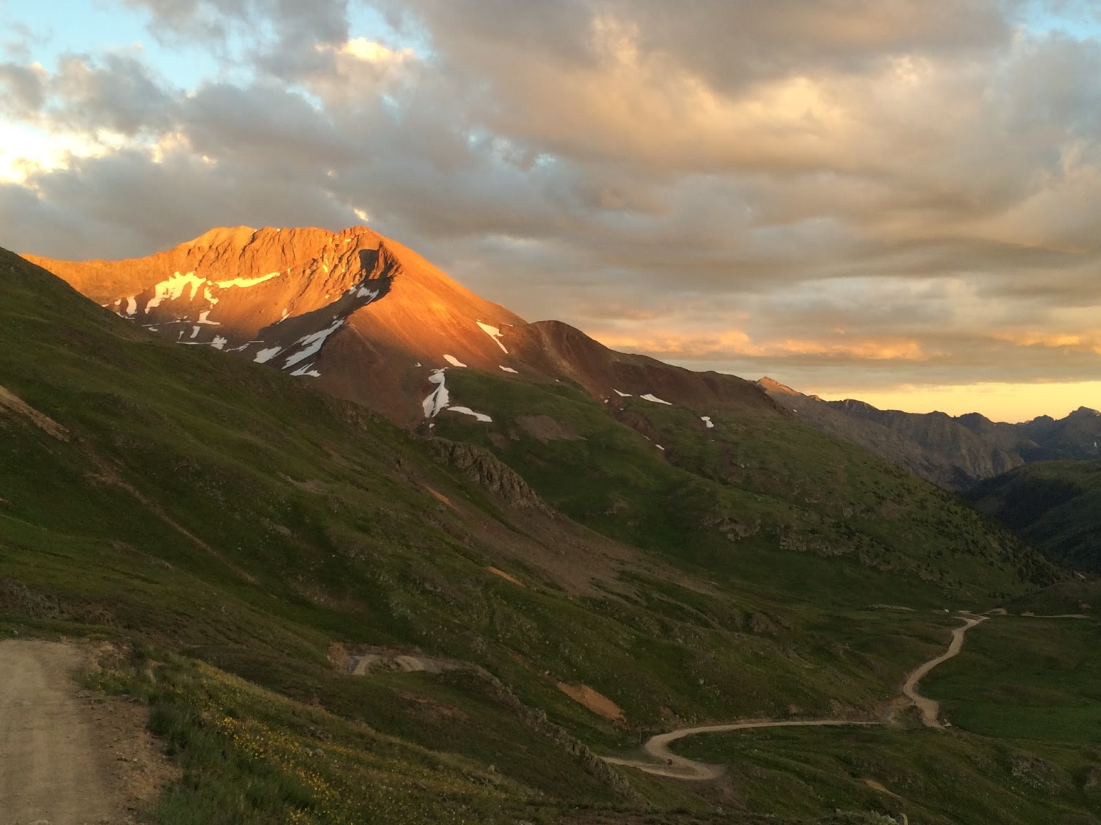
Good news: after I collected myself we started our assent up Engineer Pass.  This was moslty easy jeep roads but it was so beautiful.  I was stopping at every corner to take a picture and it was taking a long time to reach the top.
Good News:  We were able to catch the last light of the day at the top of the pass!


My somewhat haggard "new" Yamaha WR250 R at the top of Engineer Pass (12.800 feet)


Good News:  The last light of the day made the scenery just so much more fantastic

Bad News: Catching the last light of the day at the top of the pass made the descent into Ouray very slow.  On top of that , the jeep road got more challenging with more rocks, drop offs, and sher cliffs on the side.

We finaly got to our hotel around 9:30pm.  Ouray is known as the American Alps.  It's  surrounded on all sides by sheer cliffs, waterfalls, and mountains.  I'll take some pictures for tomorrows update.

Good News: After a day like today, the bad news quickly fades and the good news of the fantastic single track and amazing grandjour of crossing the great divide at 12,800 feet prevails!

Tomorrow we leave Ouray and we are considering taking the tough route through Black Bear Pass.  I'm feeling a lot more stiff this morning after yesterday's crash so that will play into the decision.  Our route is shown in green on the map and the Black Bear Pass option is shown in red.  If all goes to plan, we will end up in Monticello, Utah  

Thank you for following us.

Follow us with Spot Tracker by clicking on this link:


Friday, July 24, 2015

TLWH - Back to the Main Track

We're back! We had a good ride down to Denver on Sunday and made the round trip back to San Diego without too many issues.  It was so nice to see the family!  Then today, we made the trip back to Denver and we've returned to the main track eager to continue our ride through Colorado tomorrow.

We have a funny storey from our trip to Denver: As we were approaching Denver, my wife was on the phone trying to contact the people who were renting us the storage garage to store our bikes for the week.  There was no reply, and our flight time was approaching.  She was able to contact several storage businesses, but they cannot store anything with gas in it.  When she contacted the last storage place, she got a hold of a guy named Dan.  She asked if he knew of anyone who might have a garage or covered area we could keep our bikes.  He mentioned that his landlady might have space but he didn't have her phone number - only her address.  We were desperate so we just went to her address and asked her cold.  Sherri was extremely trusting and helpful.  She let us keep our bikes on her back porch!  We parked the bikes and called for an UBER ride to the airport.


This is Dan on Sherri's back porch where we stored the bikes for the week.  Thanks Dan and Sherri!

On Friday, we took the second half of our round trip back to Denver, picked up the bikes and headed back up into the mountains to pick up our trail again.  We even found some nice dirt roads:
We had rain for about half the day which slowed us down a bit and it was a fairly long ride of 160 miles. We arrived in Salida around 8:30pm but we had time to get some new rear tires put on.  We're going to need some good tires for the tough sections of Colorado coming up in the next few days.

Thank you for following us.

Follow us with Spot Tracker by clicking on this link:
Sunday, July 19, 2015

The Long Way Home - Day 25 - ROcky Mountain Single Track

TLWH - Day 25 - Rocky Mountain Single Track

The day's plan take us from La Veta, Colorado to Salida, Colorado (shown by the blue line).  Now we are really starting to work our way up into the Rocky Mountains!
It was definetely cooler today so the jackets came back out and the grip heaters were turned on occasionally.  Now we were up in the mountains passing beautiful valleys mountains, and ranches.

We stopped at this old church.  There are so many reminders of the old west out here.  This place was clearly hand built with mud plaster on the inside.  It looks like it had been upgraded through the years with a ceiling and floor.  It's very easy to imagine people coming here in wagons, on horses, or on foot.  

'just one of so many amazing vistas along the way.

We had two delays today: First I left my pannier bag open after a stop and my baggie with all my paperwork blew out.  I discovered my mistake at the old Church but it was a 25-mile round trip back to retrieve it (of course it opened before blowing out so there was a 1/4 mile stretch of little papers along the road).  Then Hank's backpack, that was lashed on the back of his bike, came off.  That was a 15-mile round trip.  We were running late so when we approached a decision point on the route to go on single track or stay on the faster road - we chose the single track!  How could we say no to Colorado Rocky Mountain single track??

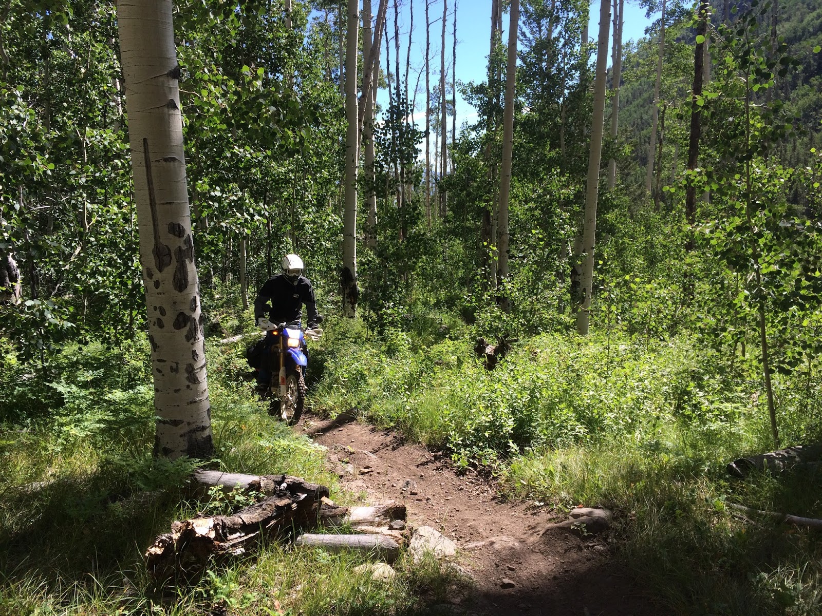
What a fantastic stretch of trail.  
Sorry, no quads.
Some of the trails had a lot of exposure.  The photos never show it very well but this felt like one slip would send our bike down a cliff where it would be completely irretrievable.  When it got even worse, I didn't stop to take a picture!

The aspen groves are always wonderful


Much of the trail was in dense forests. 

After a few hours on the single track we had to make up some time.  It was now close to 3pm and we still had over 130 miles to go.  But I had a stop planned for today that I didn't want to miss.  Bishop Castle is a crazy castle built by one man (Jim Bishop) By hand, by himself!  This was definitely the largest concentration of building code violations I have ever seen and it was completely open to the public!!  This place was awesome!
OK, my camera sort of morphed this a bit but it still looks like it felt to me standing there.  This was Jim's lifelong project.  He taught himself masonry and ironwork and just went at this piece by piece.  There are two floors with giant ballrooms and two crazy tall tours.  We had to climb both towers and you could feel the towers moving as people came up!  The stairways wound around inside the towers in super steep and very narrow spiral staircases.   
Yes, we had to climb to the very top of all three towers!

This one was the highest tower, and gave us a good dose of vertigo!

If you ever get a chance  to visit Bishop's castle, I'd strongly recommend it.  It's clear that the state is after Mr Bishop to close this place down.  He's currently fighting lawsuits from the state and it's clear that there is a liability suit waiting to happen.  I applaud him for sticking to his beliefs against all of that.

After our visit to Bishops, we ran into some rain so we stopped for dinner with about 80 miles left to go.  It was 7 pm when we hit the road again and we were faced with another decision:
Our planned route would take us to the left in this photo.  It was a trail called the rainbow trail and it sounded very fun.  But it was clearly pouring rain.  To the right was clear and it was 7pm with 80 miles to go..... OK, this time we will take the easy way out. 
Just as we started on our easy way out, we were rewarded with this.  Maybe it's a sign that we made the right choice!

 We rolled into Salida, Colorado shortly after 8 pm.  Just as it was getting dark.

Today was our last ride on The Long Way Home for one week.  Tomorrow we head out to Denver to take a flight back to San Diego for five days (shown by the purple line on the map above).  Hank is going to his college orientation for Cal Poly Pomona. I have to say that we both are looking forward to a small break and a chance to see our loved ones.  We've been pushing pretty hard for 25 days straight.  So far, this is what we have accomplished:
I think we have traveled in 19 different states. and put 5000 miles on our motorcycles!  When we return next Saturday, July 25th, we will continue The Long Way Home through Colorado, across the great divide, through Utah and Arizona, and finally into California.

Thank you all for following us.  Your kind words and interest in our journey have been very encouraging.  A huge thank you, especially, to my wonderful and so supportive wife.  Without her support, none of this would be possible! 


Follow us with Spot Tracker by clicking on this link: