Tuesday, July 28, 2015

The Long Way Home - Day 29 - Utaaaah

Tuesday, July 28th

Today was a relaxing day in Utah with relatively low mileage and mostly easy dirt roads.  The day's ride took us from Bull Frog, Utah to Escalante.
The early part of the ride was centered around the Burr Trail.  We were on and off it several times to include some more challenging roads.
This is an area known as the Burr Trail Switchbacks.  

Capital Reef Park


After completing the Burr Trail, we started on a road called Hells Back Bone.  This was slightly more challenging and it definitely switched up the scenery


Our second "Where's Waldo".  This time it's Hank in the reeds.

Hank was looking for some extra credit so he rode around this rock for a while.  That's him coming down in the middle of the photo (It's a really big rock): 

Tomorrow we head south and pass by Lake Powell one more time before leaving Utah and entering Arizona.  We'll be traveling through a lot of Indian owned land in Arizona and I'm not at all sure about how open the roads are.  There is a good chance we will have some small adventures.

Arizona is one state away from California!

Thank you for following us.

Follow us with Spot Tracker by clicking on this link:


Monday, July 27, 2015

The Long Way Home - Day 28 - Ferries Are Real!

Monday, July 22, 2015

Today was all about Utah.  The plan takes us from Monticello to Hite for gas.  Then we head south and eventually come back to Lake Powell at Halls Crossing.  At Halls, we take a ferry across to Bull Frog for the night.

The day started out with some fun, fast, mountain roads.  


My self-portrait

Hanksville is exciting! ...Blanding is, well, ...not exciting

It was quite a change from the 13,000-foot passes we were on yesterday!  It's amazing how fast the terrain has changed - just as beautiful but in completely different ways. 


That butte in the distance is called Jacob's Chair.  There are lots of great names on the buttes around here like Cheese Box and Bear's Ears.


We were trying to set a pace that would get us to Halls Crossing by 2pm.  We had left at 6:30 am and figured that we needed about a 30 mph average to make the last ferry.  We rode without fault or stop for two hours but found that we were only averaging 25 mph on these twisty roads.  I rerouted us to shorten the route and eliminate the stop in Hite.  When we reached a point where I could check the mileage, it looked like we would be about 10 miles short on our range.  This forced us to head into Hite for fuel.  From here we had 100 miles and about 3.5 hours so I added a few more road miles to speed it up and we made it to Halls Crossing with 30 minutes to spare.   

When the ferry pulled in, we were the only ones waiting.  It was strange to see the ferry run into the beach far to the left of the ramp.  Then they backed up and came in again.  This time they rammed the dock off to the right of where they should be with a loud crash and the solid poles of the dock flexed so much the entire ramp slid up the slope.  We felt ourselves backing up!
At this point, we were questioning  if we should get on this boat.  The third try they rammed the post again, but they were closer to being lined up.  Finally, they got it docked and the vehicles on the ferry were allowed to drive off.  We were the only ones waiting and after a few minutes, the captain announced over the loud speaker that the ferry is broken and they are not going to Bull Frog!  One of the crew came out to tell us that the front thruster was not working and they could not risk the trip (that explained a lot).

This left us with a new dilemma: Riding around the lake would take around 3 hours which was possible but the thought of 3 hours on pavement with these dirtbikes was not at all appealing.  I was frustrated and ornery, but Hank convinced me to go ask around to see if someone else could get us across.  I was not one bit confident that this would work, but I thought I'd honor his enthusiasm.  One thing led to another and we were hooked up with "Captain Tony" .  Tony got on his radio and got a hold of Captain Robin who just happened to be on her way to Halls to pick up an Ice Truck.  She agreed to let us on her barge!!  
An Ice Truck is a semi-truck used to haul huge containers of block ice.  We learned from Captain Robin that Ice is the biggest $$ item at Lake Powell

Underway!

'with Captain Robin.  She certainly made our day!
It was funny to throw the mandatory life preserver over our motorcycle gear.

This is the view from Defiance House (our hotel):
Another great end to another great adventure.

Tomorrow we head west to Escalante, Utah (shown in green).  I've ridden parts of this ride before and I know we are in for some challenges. 

Thank you for following us.

Follow us with Spot Tracker by clicking on this link:


Sunday, July 26, 2015

The Long Way Home - Day 27 - Two Dumbs make a Smart

Sunday, July 26, 2015

Our day started in Ouray, Colorado and we were faced with a decision: Would we head over the optional Black Bear Pass or stick to the easier Imogene Pass.  Truthfully, I was really sore and stiff from yesterday's crash but I was still on the fence.  Then we looked at the weather and it was calling for thunderstorms all across the area which caused me to chicken out.  If I had a picture of a chicken I'd post it right here:

Imogene Pass would lead us into Telluride and from there we'd head west to Monticello, Utah.
 

Leaving Ouray we snapped this photo.  It's clear why this area is known as the American Alps.


The trail up Imogene Pass was spectacular and it made me forget all about Black Bear Pass. 


Over 13,000 feet!

I was busy stopping at every corner to take pictures but Hank found a good spot to wait.  

From Imogene Pass, we headed west to Telluride.  Heading down into Telluride we could see Black Bear Pass.  The switch back road leads up to the pass which is out of sight to the left.
There were no thunderstorms and it looked so close.  Now it appeared that our first decision to skip Black Bear Pass was a dumb decision so we thought lets make another dumb decision and go back up and then down Black Bear Pass. - Brilliant!  We hustled down the remainder of Imogene Pass Road, through Telluride and up Black Bear Pass.  About 80% up the mountain, there was a sign saying that only downward traffic is allowed.  Shoot.... we didn't come all the way up here to not go up the pass.  We continued thinking that we could easily get out of anyone's way.  It all worked out and we made it up and back down.    


We met John and Chris working their BMW 1200s down the pass.  Our bikes went up and down  pretty easy but these big bikes are a real workout on this stuff.  We helped them down a tiny portion of the tough stuff and they insisted on buying us lunch in Telluride.  -That's our second sponsored meal!  Thanks guys and good luck on your adventure.


Telluride

After lunch with John and Chris in Telluride, we started on the remainder of the day.  We had only covered 35 miles of our planned route and it was 3pm.  Hank made me promiss we wouldn't stop for pictures so there are no pictures of the next 150 miles!
....except for this one I took while riding!  I was shocked to see how fast the terrain changed from mountains to farmland.  

We pulled into Monticello, Utah around 8pm.  It was another long day but the two dumb decisions resulted in us getting up and down Black Bear Pass which we've been thinking about for a few weeks.

Tomorrow is a long day and we have a deadline of 2pm to make the ferry at Hall's Crossing or we don't get a bed for the night!  The green line on the map shows the route.  It's just over 200 miles and we're thinking that we have never made that distance by 6pm -four hours too late.  We're going to have to come up with a new approach!

Thank you for following us.

Follow us with Spot Tracker by clicking on this link:


The Long Way Home - Day 26 - Good News, Bad News

We were eager to get started this morning after taking 4 days off to take the round trip to San Diego and back.  I got up early to change out my clutch that had burned out when we were in the back raods of Maine.  Our quick fix of the clutch amazingly lasted another 5000 miles but it was starting to show signs of failing again so we changed that out before the tough Colorado and Utah sections coming up.
The ride for day 26 takes us from Salida, Colorado to Ouray, Colorado.  This really gets us up into the great divide.  We will cross Engineer Pass at 12,800 feet right before decending into Ouray for the night.
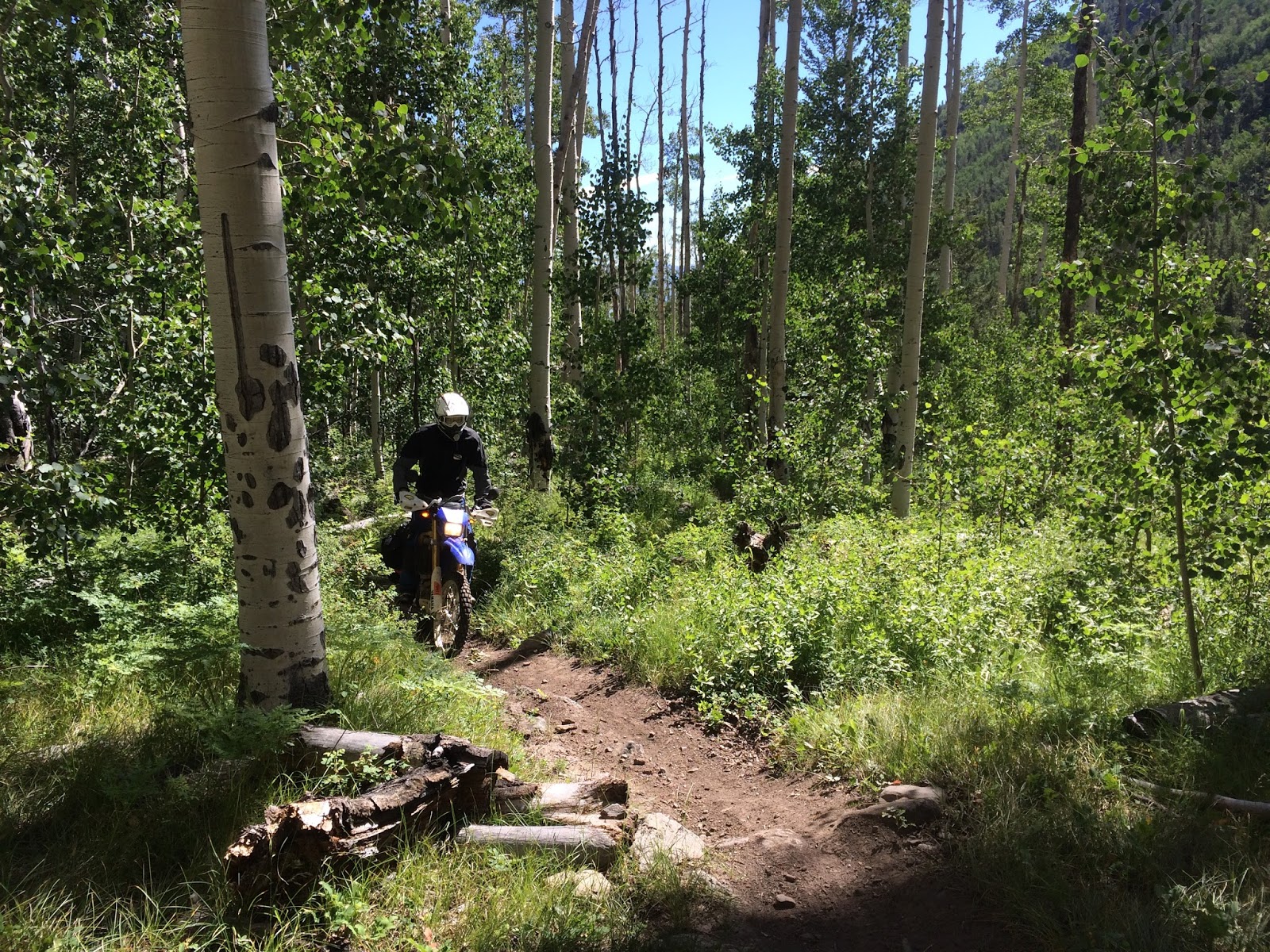
Our day started out with an option right away.  We choose the tougher single track option shown in red on the map.  Good news: This was fantastic, tough single track and very beautiful.

We were impressed by this beaver dam.  It was more that 10 feet tall on the downstream side and it was 100 feet wide.  Amazing engineering!   

Not all of the trail was smooth single track.  Lots of it was rocky hill climbs and downhills like this one.


We met this couple on their bikes.  When they heard we were headed to Ouray they replied, "How the @*& are you getting to Ouray from here?".  We weren't exactly sure but we knew we had to head west.  They pointed to a mountain on the horizon and said Ouray was past that.  Wow, we better get going. 
They have two young kids and were wondering if they could get them on the Trans America Trial in a few years.  They offered to pull out their recreational cannabis to give us the full "Colorado image" for the photo (they were only kidding... i think)

We continued our climb on the single track and eventualy got above the tree line.  

Bad news: We had so much fun on the single track that we had lunch at 2:30 and we still had 130 miles left to go.  
Good News: We had some fast roads to catch up on:


Every corner brought more amazing vistas.

Bad news: The amazing vistas and fast roads combined to cause me to loose my focus on the road and I went into a corner too fast.  The bike was sliding both wheels to the left, then I over corrected it to the right where the tires suddenlty decided to catch and it sent me over the top. I'm not sure how, but I have a badly bruised jaw, sore knee, bruised hip, and my shoulder is really stiff.  The bike faired better with only a broken mirror and bent clutch lever and handguard.  It still runs fine, it only looks a little more haggard.

Good news: after I collected myself we started our assent up Engineer Pass.  This was moslty easy jeep roads but it was so beautiful.  I was stopping at every corner to take a picture and it was taking a long time to reach the top.
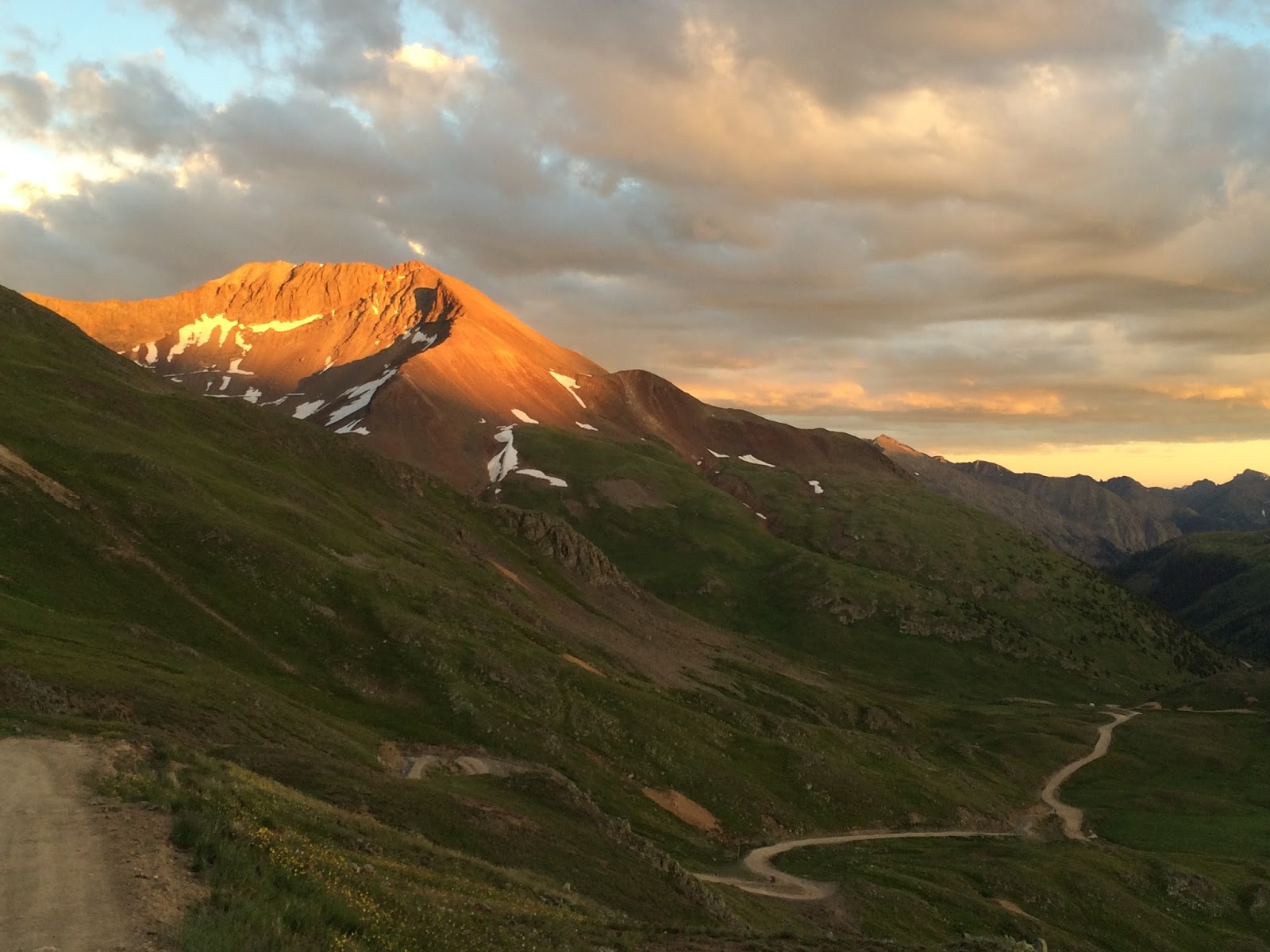
Good News:  We were able to catch the last light of the day at the top of the pass!


My somewhat haggard "new" Yamaha WR250 R at the top of Engineer Pass (12.800 feet)


Good News:  The last light of the day made the scenery just so much more fantastic

Bad News: Catching the last light of the day at the top of the pass made the descent into Ouray very slow.  On top of that , the jeep road got more challenging with more rocks, drop offs, and sher cliffs on the side.

We finaly got to our hotel around 9:30pm.  Ouray is known as the American Alps.  It's  surrounded on all sides by sheer cliffs, waterfalls, and mountains.  I'll take some pictures for tomorrows update.

Good News: After a day like today, the bad news quickly fades and the good news of the fantastic single track and amazing grandjour of crossing the great divide at 12,800 feet prevails!

Tomorrow we leave Ouray and we are considering taking the tough route through Black Bear Pass.  I'm feeling a lot more stiff this morning after yesterday's crash so that will play into the decision.  Our route is shown in green on the map and the Black Bear Pass option is shown in red.  If all goes to plan, we will end up in Monticello, Utah  

Thank you for following us.

Follow us with Spot Tracker by clicking on this link: